ForeFlight Mobile


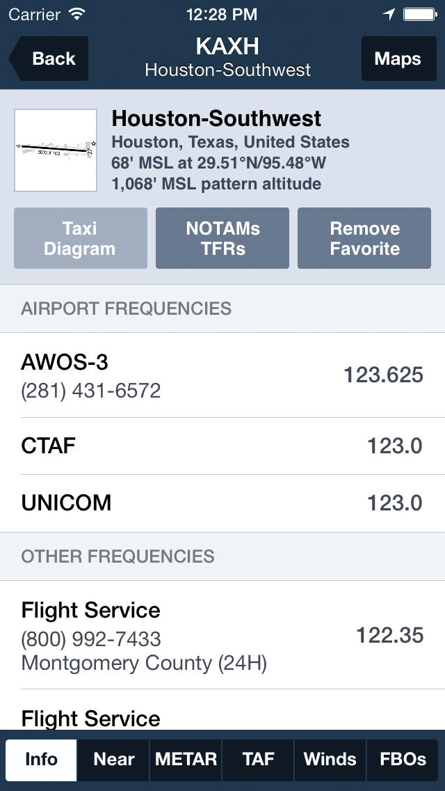


ForeFlight Mobile is the critically acclaimed flight planning, flight support, and electronic flight bag ("EFB") app for pilots. Navigation charts, Internet and in-flight weather, airport facility directory information, moving map, hazard and terrain awareness, aviation documents, and much more. Built with an attention to detail and backed by a dedicated, fanatical support team, ForeFlight is a best selling aviation app for iPad, iPhone, and iPod touch. Continued ForeFlight service requires a subscription, available via in-app purchase. REVIEWS AND PRAISE - Editor's Choice, Flying Magazine, January 2014 - Editor's Choice, Flying Magazine, January 2013 - Editor's Choice, Flying Magazine, January 2012 - App of the Year, Aviation Consumer, July 2011 - Best Selling iPad Aviation App: 2010, 2011, 2012, 2013 - "Best app for IFR" - Aviation Consumer - "One of the most popular and most-respected aviation apps available" - Sporty's Pilot Shop, July 2010 AIRPORT AND FACILITY DIRECTORY ForeFlight's A/FD provides information about US and major international airports. Data is provided by government authorities, the AOPA, and Universal Weather and Aviation. Critical airport information is displayed elegantly and additionally provides METARs, TAFs, winds aloft, and NOTAMS. PLATES & CHARTS ForeFlight provides access to US VFR and Terminal Area (TAC) charts; US and Canadian VNC/IFR en-route charts; area and gulf helicopter charts, and 15,000 US and 2,000 Canadian instrument procedures. En-route charts and over 12,000 terminal procedures are geo-referenced. WEATHER ForeFlight's weather is best-in-class. 10 weather Slip Maps(TM) with route overlay, pinch and zoom support, and touch planning support deliver information about conditions along your route quickly and visually. In-flight weather is possible via Stratus ADS-B or XM. Maps include: - Flight rules - HD NEXRAD composite radar - Visible and IR satellite - Visibility - Lightning - Temp and dew-point spread - Sky coverage - Wind conditions - Global winds aloft TOUCH PLANNING & MOVING MAP Plan flights by touch to draw a route of flight, bend a route around weather, and add or drop waypoints. 'Direct To' functions get you where you want quickly. Engage the moving map and see your ship's position on top of en-route charts; use the customizable dashboard to display groundspeed and altitude, track, GPS accuracy, or one of 15 different instruments. AIRWAYS/SIDS/STARS ForeFlight supports airways, SIDS, STARS, and providers cleared ATC routes. Use multi-runway SIDS, airway entrances/exits, intersections, airway identifiers, and even the most complex STARS. FUEL PRICES ForeFlight provides fuel price information, visually color coded by price, for 2,300+ FBOs in Canada and the US. Pilots can also submit fuel price updates in-app. FLIGHT PLAN FILING File flight plans from your iPhone or iPad and get confirmation in seconds. Copies are stored on our servers for safe-keeping; email confirmations and briefings are sent automatically. DOWNLOAD MANAGER Select the regions and information you need. Download one area or the whole country from our highly reliable delivery network. Plate and chart volumes install in seconds. COMMENTS Submit comments directly from device, wherever you may be, and read comments from other pilots. You may just find a great place for fried pickles. CREDITS - Canadian radar coverage is provided by Environment Canada. - International A/FD provided by Universal Weather and Aviation.


